Home Submit URL Add to Favorite Contact
           20 May, 2024
 
    
Science » Earth Sciences » Geomatics » Photogrammetry

UPDATE INFO | REPORT BROKEN LINK

Inpho

Popularity:    Hit: 1049
Details:
Supplier of systems for aerial triangulation, DTM modeling, image matching, and feature extraction
URL: http://www.inpho.de/
Title: inpho - leader in photogrammetry and digital terrain modeling
Image:
Description: 
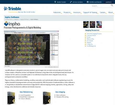
INPHO is an end-to-end photogrammetric systems supplier. INPHO products cover the entire workflow of photogrammetric projects, including aerial triangulation, stereo compilation, terrain modeling, orthophoto production and image capture. In addition, INPHO offers innovative software solutions for processing digital terrain models, including advanced filtering and editing of LIDAR data.
Specialized in: Digital Photogrammetry - Lidar - Data Capture - Digital Elevation Models - Dem - Mapping

Related Sites 
Environmental Remote Sensing Center (Popularity: ): Remote Sensing and Digital Photogrammetry. Chairs: Dr. Thomas Lillesand and Dr. Frank Scarpace.
DAT/EM Systems International (Popularity: ): Software for digital mapping and photogrammetry.
TerraServer (Popularity: ): Online subscription service providing access to a database of high resolution satellite and overhead imagery from all over the world.
MAN Mapping Services Home (Popularity: ): Topographic mapping, GIS base data and digital orthophoto imagery services under the supervision of Larry Mumford and Bob Niepert.
GeoLas Consulting (Popularity: ): Provides consulting services for imaging laser altimetry/airborne laser mapping technology and applications, and 3D geodata processing and visualization services.
LaFave White & McGivern LS PC (Popularity: ): Land Surveying and Photogrammetric Mapping
Cartwright Aerial Surveys, Inc. (Popularity: ): Photogrammetric services including aerial photography, digital topographic mapping, orthophotography, and digital terrain modeling.
National Aerial Resources (Popularity: ): Provides aerial photography services including research and acquisition of aerial photography.
Aero Geometrics (Popularity: ): Aerial survey and digital mapping.
Airborne 1 Corporation (Popularity: ): Operates across the United States with Lidar technology to create digital maps for land surveying firms.


Popular Sites
National Aerial Resources (Popularity: ): Provides aerial photography services including research and acquisition of aerial photography.
DAT/EM Systems International (Popularity: ): Software for digital mapping and photogrammetry.
Ace Aerial Photography, Inc (Popularity: ): Aerial photography, topographic mapping and digital orthophotos services along with a large inventory of historical aerial negatives.
Environmental Remote Sensing Center (Popularity: ): Remote Sensing and Digital Photogrammetry. Chairs: Dr. Thomas Lillesand and Dr. Frank Scarpace.
MAN Mapping Services Home (Popularity: ): Topographic mapping, GIS base data and digital orthophoto imagery services under the supervision of Larry Mumford and Bob Niepert.